
The position and height of the sea relative to the land
the average height for the surface level of a body of water
e.g. Maine, Labrador etc.
393 feet
Sea level is a reference to elevation of the ocean/land interface called the shoreline. Land that is above this elevation is higher than sea level and lower is below sea level. Because high and low tides change the shoreline interface, the standard U.S. definition focuses on the average high tide line over a 19 year period.
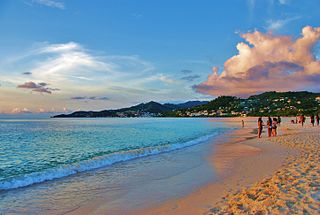 Shoreline is the measure of where the land meets the ocean and is used to describe sea level.
In the U.S. the legal shoreline is the location of mean high water (MHW), or the average high tide line for an area.
Shoreline is the measure of where the land meets the ocean and is used to describe sea level.
In the U.S. the legal shoreline is the location of mean high water (MHW), or the average high tide line for an area.
While we often refer to sea level in global terms, such as when we discuss sea level rising, in reality it varies from place to place. Therefore it is defined both locally and globally. Our shorelines are used to define local or relative sea level. Relative sea level is measured through tide gauges that have been precisely placed and referenced to established benchmarks on land. The gauges provide a constant for measuring any change in the elevation of where the water and land intersect.
We experience relative sea level when we visit the shoreline, that narrow area between the land and the water. If we watch the shoreline we can see it is not constant throughout the day, it narrows and expands in an oscillating pattern that depends upon tides and winds, however tides and winds do not define sea level. We use mean sea level (MSL) to remove these processes from the calculations. MSL is the midpoint at a given location between mean high tide and mean low tide.
Since relative sea level is the position and height of the surface of the sea relative to the adjacent land, changes in this may be caused by absolute changes of the sea level and/or by up and down movements of the land at the edges of the continents. Absolute changes of sea level are global changes that would occur from variations in the volume of water in the oceans as water moves between frozen ice sheets and liquid oceans, or in changes in the size of the ocean basins from tectonic activity. Both of these examples are changes that occur over a long period of time. Regional or local changes occur at the edges of the continents from activities like land uplift or subsidence such as from an earthquake. When exploring other sections in this app you will see that when large amounts of ice melt it can affect sea level in both of these ways. Locally the surface of the land, once weighted down by the ice cover and pushing down on the Earth's softer interior mantle, slowly rises when the ice melts. The mantle material is rebounding causing the overlying earth layers to move upwards. This rising of the land is a slow process and today it is still occurring after the last ice age in places like Scandinavia, Alaska, and parts of northeastern North America even though the majority of the ice sheets melted away more than 12,000 years ago. Globally the meltwater from the ice sheets adds to the overall volume of the oceans. After the last ice age the addition of meltwater was significant adding approximately 120m. of sea level rise globally.
There are a range of other factors affecting sea level that can be explored in this app.